Enhancing Airport Security through Advanced Geospatial
Enhancing Airport Security through Advanced Geospatial
Imagine you're watching the bustling scene at a major international airport, where the usual mix of travelers and staff navigate through the complex web of terminals and gates. In this hive of activity, a single unattended bag near a busy check-in counter could spell disaster. Thanks to advanced geospatial technology, however, the potential crisis is averted.
Airport mapping systems quickly identify the anomaly, enabling security personnel to respond swiftly and efficiently. According to recent studies, deploying advanced geospatial solutions can enhance threat detection rates, showcasing the critical role these technologies play in maintaining safety in our skies.
Enhancing Airport Security through Advanced Geospatial
In the high-stakes environment of airport security, the adoption of advanced geospatial technology has become a game-changer. This technology, which includes sophisticated airport mapping systems, is not just about observing, it's about proactively managing and mitigating risks before they escalate into real threats.
How Does Geospatial Technology Strengthen Airport Security?
Geospatial technology utilizes data collected from GIS (Geographic Information Systems), satellite imagery, and sensor networks to create a comprehensive overview of airport environments.
This technology aids in everything from routine monitoring to emergency response, providing a bird's-eye view that is crucial for effective security management.
Key Benefits of Geospatial Technology:
- Enhanced Surveillance: Continuous monitoring of all airport zones, including less accessible areas.
- Improved Response Times: Quick identification and response to potential security breaches.
- Optimized Resource Allocation: Efficient deployment of security resources based on real-time data.
By integrating these elements, airports can not only detect, but also preemptively respond to potential security threats.
Real-Time Data: A Closer Look
One of the standout features of advanced geospatial technology is its ability to provide real-time data to security personnel. This is crucial in managing day-to-day operations and in responding to emergencies. Real-time data allows for:
- Immediate detection of unauthorized access or unusual activities.
- Live tracking of suspect movements within and around the airport.
- Coordination of security teams for rapid response.
The application of real-time data is seen in numerous international airports where it has significantly reduced the time to respond to incidents, thereby enhancing overall security protocols.
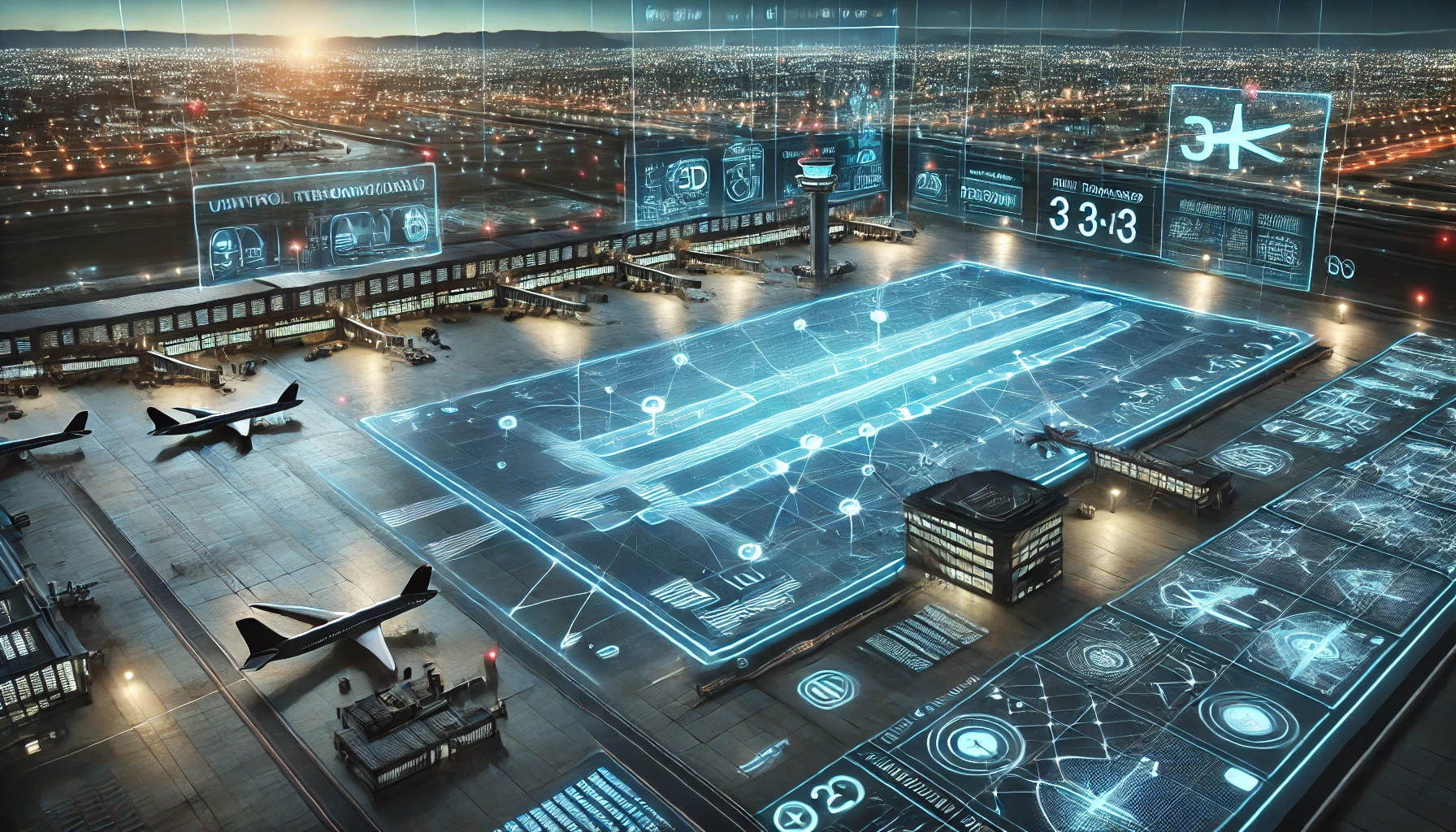
Advanced Geospatial Solutions in Action
Let's explore how specific geospatial tools are applied in airport security through an example:
- Thermal Imaging Cameras: These tools detect heat signatures and are crucial in nighttime surveillance and in areas with poor visibility.
- Motion Sensors: Integrated with GIS, these sensors trigger alerts when unexpected movement is detected in restricted areas.
These technologies work in unison to create a security network that is both resilient and adaptive to potential threats.
How Geospatial Technology Maps a Safer Airport Environment
|
Geospatial Tool |
Function |
Security Benefit |
Example of Use |
Impact on Security |
|
Thermal Imaging Cameras |
Detects heat signatures |
Helps in night surveillance and low visibility |
Identifies suspicious movements in dark zones |
Enhances perimeter security |
|
Motion Sensors |
Detects movement in restricted areas |
Triggers alerts for unauthorized access |
Alerts security when an intruder enters restricted areas |
Prevents security breaches |
|
AI-Powered Video Analytics |
Analyzes surveillance footage in real time |
Identifies unusual activities |
Recognizes abandoned baggage or suspicious behavior |
Reduces threat response time |
|
GIS-Based Airport Mapping |
Provides a complete 3D airport layout |
Improves navigation for security teams |
Security can zoom in on terminals and runways |
Faster deployment of personnel |
|
Crowd Density Monitoring |
Tracks passenger flow in real-time |
Prevents overcrowding and security bottlenecks |
Identifies areas where extra security is needed |
Ensures better crowd control |
The Future of Airport Security with Geospatial Tech
Looking ahead, the role of geospatial technology in airport security is set to expand. Innovations in AI and machine learning are expected to further enhance the capabilities of geospatial systems, making them more predictive and proactive.
Airports around the world are investing in these technologies to ensure they remain ahead of the threats posed by global travel and transport.
Implementing Advanced Geospatial Solutions
While the benefits are clear, the implementation of advanced geospatial systems in airports involves strategic planning and consideration. It requires:
- Investment in Technology: Significant funding is necessary to adopt and integrate advanced systems.
- Training Personnel: Staff must be trained not only to operate the systems but also to interpret and act on the data provided.
- Maintaining Privacy: Ensuring that the use of advanced surveillance technology complies with legal and ethical standards.
Enhancing Response Strategies with Real-Time Geospatial Data
The power of real-time geospatial data is truly transformative for airport security. This technology does more than just watch; it provides immediate insights that are crucial during emergencies. When something unusual is detected, like someone entering a prohibited area, the system alerts security instantly. This allows for a quick response, potentially stopping threats before they escalate.
Real-time data also helps manage everyday security operations smoothly. For example, during peak times when the airport is crowded, geospatial tools help monitor crowd density and flow.
This helps in deploying extra personnel to areas that are experiencing bottlenecks or where larger crowds gather, enhancing overall safety. In emergency evacuations, knowing the exact location of everyone inside the airport through geospatial data ensures that no one is left behind and that everyone is guided safely out of the facility.
This proactive approach supported by geospatial technology not only boosts the effectiveness of security measures but also builds trust among travelers, who rely on airport authorities to keep them safe while traveling.
Final Thoughts
As we advance further into the 21st century, the role of geospatial technology in ensuring the safety of air travel becomes increasingly indispensable. With each improvement in airport mapping and surveillance technology, airports become safer for passengers and more secure against threats.
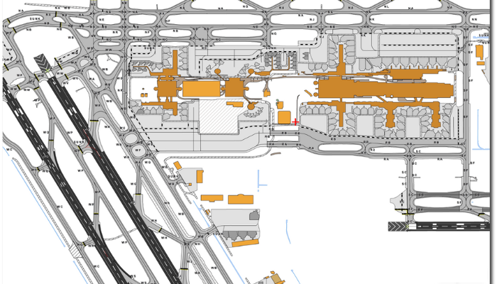
A great example of this innovation is AMDB by SATPALDA, a cost-effective solution that supports airport security, pre-planning, and navigational mapping. With highly detailed airport layouts, elevation data, and obstacle mapping, AMDB plays a key role in improving aviation safety and efficiency.
To learn more about geospatial solutions for airport security, visit amdb.biz.
FAQs
- What is airport mapping?
Airport mapping involves the use of GIS and other geospatial data to create detailed maps of airport facilities for security and operational purposes.
- How does real-time data enhance airport security?
Real-time data helps security personnel react swiftly to potential threats, ensuring immediate and effective responses.
- Can geospatial technology predict potential security breaches?
Yes, with advanced analytics and AI, geospatial technology can predict and alert personnel about potential security breaches before they occur.
- Is geospatial technology cost-effective for airports?
While initial investments are high, the long-term benefits of improved security and efficiency make geospatial technology a cost-effective choice for airports.
5. Why is geospatial technology important for airport security?
Geospatial technology is crucial because it helps security teams visualize and manage airport spaces more effectively. It allows for the tracking of objects and people in real-time, ensuring all areas are monitored and secure, which is essential for preventing security incidents.